
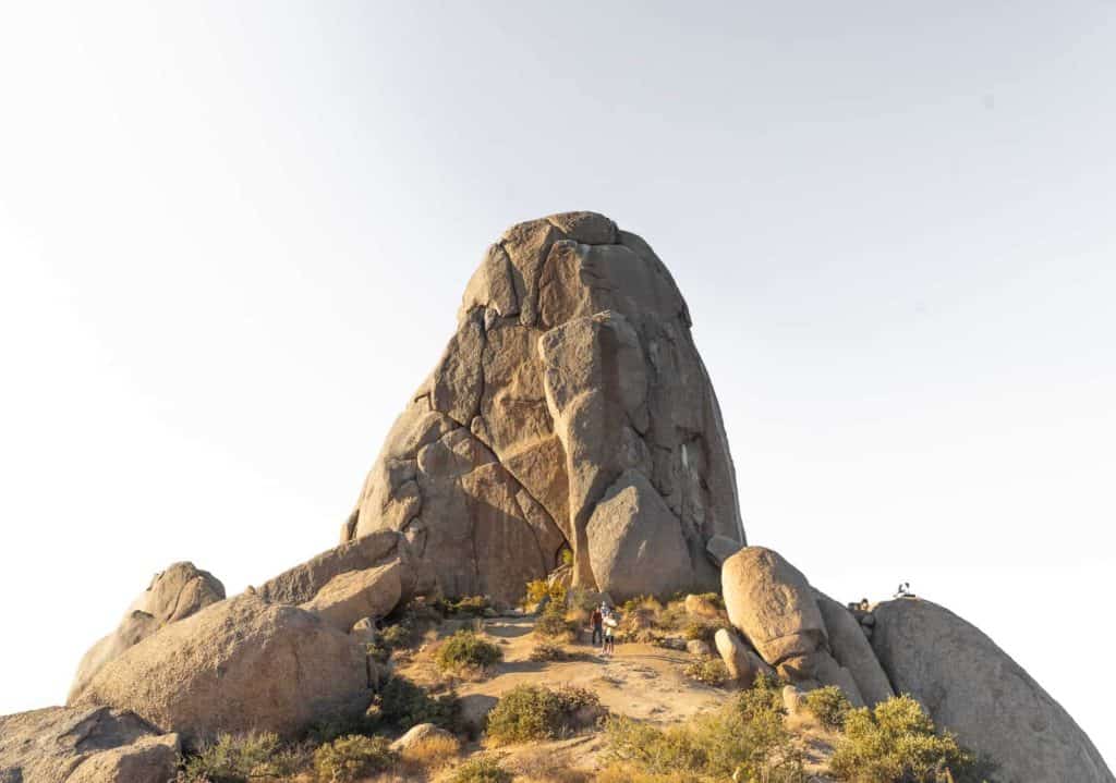
Named after a local rock climber, Tom Kreuser, Tom’s Thumb has become one of the most popular rock formations to visit in the Scottsdale McDowell Sonoran Preserve. The smooth, bare, rock resembles a thumb sticking out of the ground, and has become an iconic destination for both hikers and climbers.
If you’re looking for a somewhat challenging day hike within the Phoenix Valley, Tom’s Thumb is a great option. The McDowell Mountain area is the perfect scenic escape from the city without having to go too far.
In this post I am going to go over all of the trail stats, tips, and more so you’re prepared to tackle it yourself!
Tom’s Thumb Stats
- Hiking Distance | 4.20 miles
- Difficulty | Moderate
- Elevation Gain | 1,086 feet
- Permits/Fees | None
- Trailhead | Tom’s Thumb Trailhead
- Dog Friendly | Yes
Note: There are several ways to hike Tom’s Thumb. This post is going to cover the most popular and direct route as an out-and- back.
Local Tip
Tom’s Thumb is also popular for rock climbers. This may be an option for you if you climb- you can get more info here.

Getting To Tom’s Thumb Trailhead
The best way to get to the trailhead is to follow the directions here.
Tom’s Thumb Trailhead begins from a large parking lot accessed off of N 128th Street in Scottsdale. The roads are well maintained but do become narrow and windy as they lead to the base of the mountains. Overall the drive is easy and there are plenty of signs to lead you to the trailhead.
I always recommend tracking yourself or following an already made track so you can check in and be sure you’re on the right path. Below is a screenshot of my track from Tom’s Thumb!

Preparation saves lives. Know where you are going ahead of time and always have a way to keep yourself on trail. One way to do this is with a GPS system or app.
You can download my Tom’s Thumb track and gain access to my library of all tracked hikes. Once downloaded, you can load it into your own trusty devise for ease of mind!


When To Hike Tom’s Thumb
Like most trails in the Phoenix Valley, the best time to hike is Spring, Fall, and winter (or November-April) when the temperatures are well below 100 degrees. The mornings and evenings will be chilly, but once the sun makes an appearance it’ll usually heat up to about 60-70 degrees mid-day.
If you’re determined to hike during the summer it is best to begin at sunrise and complete the hike by late morning before the heat really hits.
The trailhead is only open from sunrise to sunset and it is strictly enforced. Keep this in mind when planning your visit!
LOCAL TIP!
The gates to the trailhead parking lot close strictly once the sun is down. Make sure you’re out in time so you don’t get locked in!
Hiking Tom’s Thumb
At the beginning of the trailhead there are restrooms, shaded seating, and informational plaques, but no water! Be sure you’re bringing 2-3L with you to be safe.
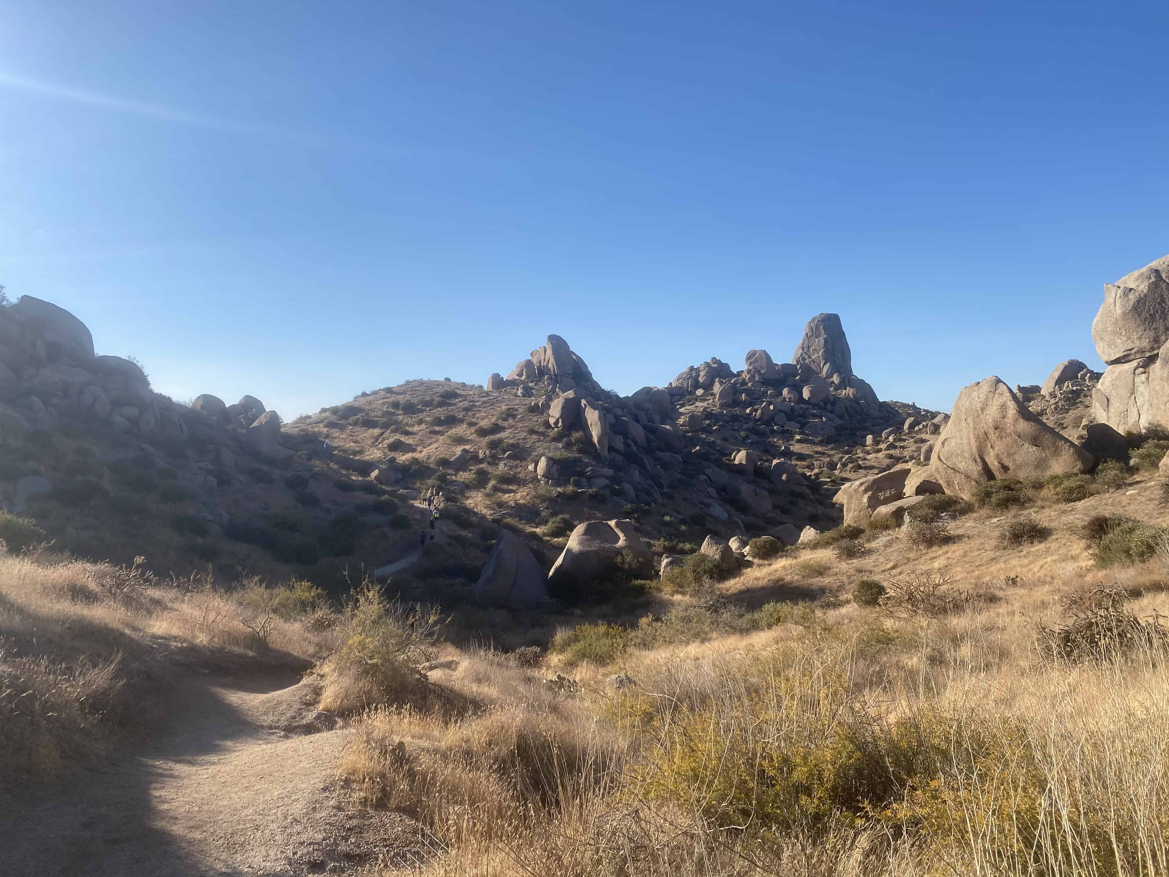
The hike begins relatively flat and wide as you trek through open desert. Less than a mile in and Tom’s Thumb Trail gradually starts narrowing and inclining as you begin weaving in-between rock formations and climbing elevation. Depending on your fitness level the trail will quickly become difficult as you traverse the switchbacks up the mountain.
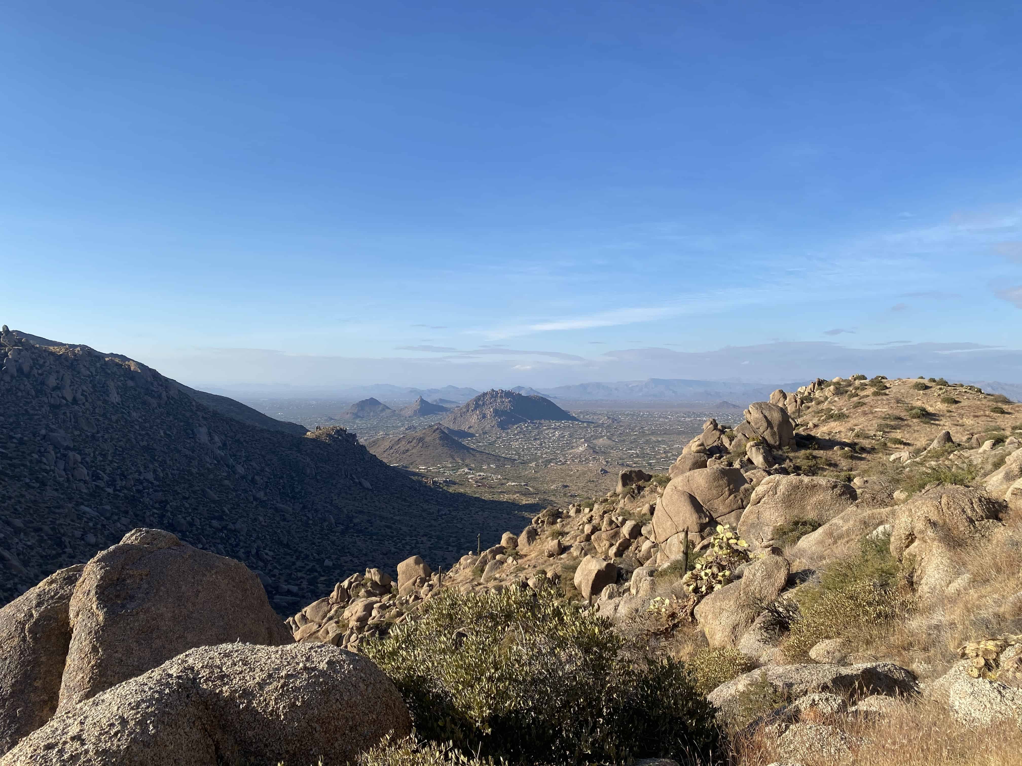
Luckily there are plenty of beautiful lookouts along the way for you to stop, catch your breath, and take in the views. My jaw dropped at just about every turn because the views just kept getting better and better!
The McDowell Mountains have some of the best views in Scottsdale. You tend to forget you’re even in the city once get deep enough into the mountains and lose sight of it!
The first mile is the hardest so if you can get past that you’ll make it just fine! The trail continues to guide you down and across washes, up and around several other rock formations, and finally over the last little hump- a few large boulders you’ll have to scramble over.
Finally, after roughly 2.1 miles you’ll find yourself at the base of Tom’s Thumb.

Once you’ve gotten your fill of views you’ll turn around and head back the way you came.
If you’re up for a little side excursion before heading back to the parking lot, consider hanging a right off Tom’s Thumb Trail to the Lookout Trail and hiking to The Lookout. Once you reach the end of the Lookout you’ll turn around and intersect back with Tom’s Thumb Trail and continue hiking back to the parking lot!
Final Thoughts On Tom’s Thumb
Due to it’s close proximity to the city, unique rock formation, and scenic views along the trail, I can see why Tom’s Thumb has become so popular. It is a great day hike option and absolutely stunning if you trek back to the parking lot as the sun is setting.
Because of it’s popularity, it is difficult to find time alone here. Hikers come and go, hangout for a while at the base of the thumb, and even rock climb to the top at all times of the day. Just be aware you’ll most likely be sharing the area with others during your visit!
As always, please be considerate of the environment so we can keep enjoying it and remember to leave no trace.
Other hikes nearby:
- The Gateway Loop Trail- A BEAUTIFUL Scottsdale Hike
- Hike Pinnacle Peak Trail in Pinnacle Peak Park, Scottsdale
- 10 Amazing Superstition Mountains Hikes for your Bucket List
- Calderwood Butte Trail- A Hidden Gem In Peoria
- How To Hike Piestewa Peak Summit Trail