
In January 2023 Peralta Regional Park welcomed visitors to hike, camp, and ride their horses along the trails for the first time. As soon as I learned about the opening of this new park I jumped at the opportunity to hike all of its trails and stay the night under the stars.
This Arizona Regional Park is located in Gold Canyon at the foothills of the Superstition Mountains. If you’re looking for a place to escape with beautiful views and a remote environment, look no further. With a variety of trail difficulties and the bonus of a star gazing node, there is something for everyone here to enjoy no matter their age or mobility.
In this post I’ll guide you through everything you need to know when visiting Peralta Regional Park. The best time to visit, which trail(s) may be right for you, and what the campsites are like. I hiked every single trail so I can help you plan your itinerary in this guide!
Hey! Just so you know the below links contain affiliate links, which means I may receive commissions if you choose to purchase through my links (at no extra cost to you). You can visit my disclosure for more info.
About Peralta Regional Park
What I love most about Peralta Regional Park is that it was specifically designed to keep that sense of remoteness. Everything was thought through in order to provide enough amenities for visitors without negatively impacting the environment.
The park sits in the foothills of the Superstition Mountains but not near all of the popular trails. The park’s entrance is tucked back off of Peralta Road (the main access road) which only adds to that feeling of remoteness. You don’t hear or see traffic besides the park visitors.
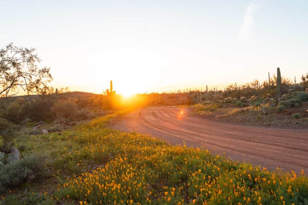
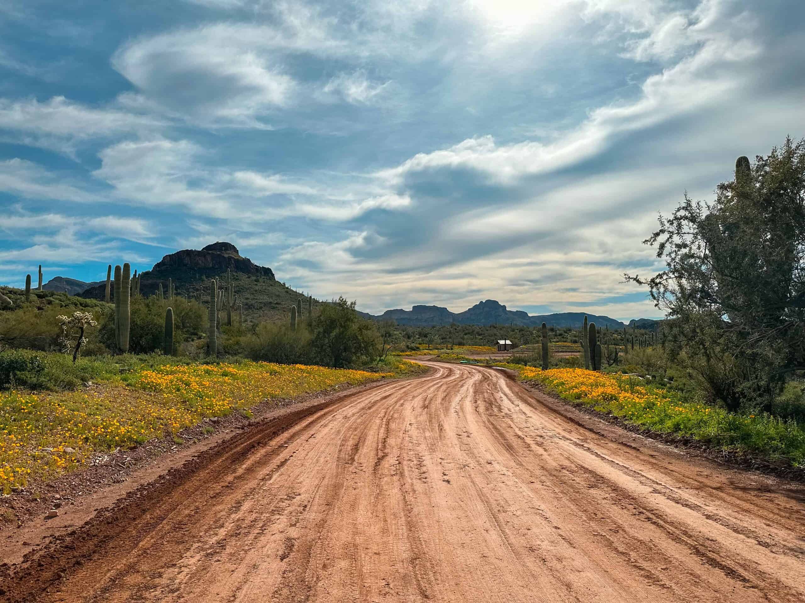
Park developers purposely didn’t over develop the area. You’ll find that all of the roads remain dirt, there is no artificial lighting and barely any signage, no electricity or water, and the structures blend in with the landscape. I especially appreciated the simple campsites that don’t allow RV’s or generators.
Quick Facts
- Location | Peralta Road, Gold Canyon, AZ
- Fees | $7 day use fee and $10/night camping fee (book online)
- Hours | Dawn to 10 PM
- Activities | Good for: hiking, backpacking, camping, and horseback riding.
- Amenities | Day use & group ramadas, vault toilets, star gazing node, and equestrian staging area.
- Dogs Allowed | Yes
Park Location
Finding Peralta Regional Park isn’t too difficult. You can input the name into Google Maps and it will direct you to the entry sign. Just make sure you select the location in Gold Canyon.
You can follow the directions below or map them here.
The Superstition Mountains are on the far east side of Phoenix and reaching Peralta Regional Park can take anywhere from 40-60 minutes depending on where you are embarking from. You’ll take US 60 East until it turns into a 2 lane road. A few more miles and you’ll turn left onto E Peralta Road. This road will lead you through a quiet neighborhood, past an elementary school, and eventurally dead end into a dirt road.
Peralta Road goes on for miles but the turn to reach Peralta Regional Park will be just a few miles down on the right hand side. There is a huge metal sign for the park but it does blend in with the environment so keep an eye out. Turn right at the sign and follow the road into the park.
Rules + Regulations
- Peralta Regional Park is open from dawn to 10 PM so be sure to check the sunrise hours the day you plan on visiting.
- There is a $7 day use fee that can be paid for online via this registration link or by QR code which you can find on the park kiosks. They do not accept any passes!
- No matter if you are camping or just stopping by for the day you are responsible for packing out what you pack in. This includes picking up after your dog and disposing of their waste!
Please help keep our parks clean by practicing the Leave No Trace principles!
Finding Your Way Around Peralta Regional Park
Don’t scroll past because this part is important! Remember when I mentioned the park has minimal signage? Well, that is a double edged sword. If you’re visiting for the first time it can be difficult to figure out where to go on their roads and trails.
To avoid confusion upon arrival I highly suggest taking a screenshot of the Peralta Regional Park map below or printing it and taking it with you.

You’ll probably find that the park map itself is a bit confusing because it is hard to tell roads apart from trails. I promise it isn’t as scary as it looks. Once you arrive and begin driving around you’ll quickly learn your way around the park with some patience!

Best Season For Visiting
It is best to experience hiking in Peralta Regional Park during the months of November- April. These are the most comfortable months for hiking in and around the Phoenix area because of the prime-time hiking temperatures. The wildflowers in this park are just gorgeous! If you want to try to time it for wildflower bloom plan a visit during March or April. My photos are from the end of February but you can see that the wildflowers aren’t completely opened up yet.
Hiking outside of these months will pose many challenges due to the extreme heat, sun exposure, and lack of access to shade and water. Since the trails within the park are shorter and less strenuous it may be possible to do a quick sunrise hike here depending on the daily temperatures. If you do hike during summer be sure to begin early and end before the late morning heat kicks in.
Hikes In Peralta Regional Park
There are 8 beautiful trails within this Arizona park that somewhat all loop together. You can hike them separately or combine them for a series of loops through the mountains.
- Desperado Trail
- Saguaro Loop
- Oro Vista Loop
- Wanderer Trail
- Stargazing Trail
- North Star Trail
- Serenity Loop
- Interpretive Trail
If you’re looking specifically for a flat, beginner level, and easily accessible trail then skip ahead to Serenity Loop and Interpretive Trail. Now let’s get into the details of each of these 8 hikes, below!
Helpful Tip!
When reading about these trails and planning your hikes it would be SUPER helpful to refer back to the park map. They can get confusing and all of these trails connect in some way.

1. Desperado Trail
Hiking Distance | 2.6 miles
Difficulty | Easy-Moderate
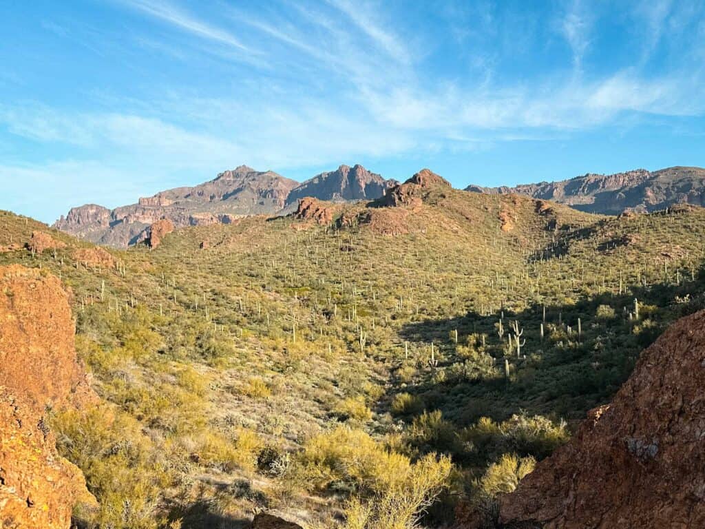
The longest trail within Peralta Regional Park is the Desperado Trail. It is rated moderate but for experienced hikers I think they’ll find it to be easy. Regardless, the trail is worth hiking because it skirts around the outer edge of the park which gives you a good idea of just how vast the Superstition Wilderness is.
Most of the trail is flat with the occasional climb in elevation but tops out at 150 feet of gain altogether. The views are beautiful especially on the back end of the park where no one else is around. If you look at the map you’ll see this trail rounds the camping areas but you hardly notice when you’re hiking it.
The Desperado Trail almost completes a loop around the entire park but instead falls just short. One end of the trail connects with the equestrian staging area while the other connects with Saguaro Loop. If you want to reach the Star Gazing Trail you’ll need to take Desperado Trail to access it. I highly suggest looping it with Saguaro!

2. Saguaro Loop
Hiking Distance | 1.2 miles
Difficulty | Easy-Moderate
Don’t let the short distance fool you- Saguaro Loop is not to be underestimated. It is my favorite trail in Peralta Regional Park and well worth the effort. Like the Desperado Trail, this one is rated moderate but experienced hikers will find it to be easy as it only climbs 132 feet in elevation. The difference is that this trail is shorter so it feels steeper.
In my opinion the Saguaro Loop was the most scenic of all trails, with or without the beautiful wildflowers lining the sides. You’ll be lead up, down, and around the foothills of little mountains within the park. Between the close proximity to the mountains and Saguaro’s scattered about, there is plenty to marvel at along the way.
You can access Saguaro Loop from any of the short connector trails (refer to the park map) or the Desperado Trail to create a longer hike if you wish.
3. Oro Vista Loop
Hiking Distance | 1.1 miles
Difficulty | Moderate
The Oro Vista Loop is short but has a nice surprise at the top. It is rated moderate due to the steep parts when climbing to the top of the little mountain. 127 feet in elevation gain will reward you with spectacular views of Peralta Road below and the iconic mountain range commonly associated with ‘The Superstitions’.
I wish I would have scouted this one out for sunset the evening prior because I have a hunch sunset here would be beautiful *hint hint*! The sun sets in the West which means it’ll set behind the iconic Superstition Mountain range, potentially painting a beautiful scene for you. If you visit for sunset please let me know!
You have the option of connecting Oro Vista Loop with Saguaro Loop by taking a short connector trail. Or you can connect it with the Star Gazing Trail and end at the star gazing node right after the sun sets.
4. Wanderer Trail
Hiking Distance | 0.4 miles
Difficulty | Easy
Oro Vista Loop can be cut in half by taking the Wanderer Trail. If you wanted to quickly climb up for sunset this is the way I’d take because the Wanderer Trail ends pretty much at the peak where you’d want to be standing at. Just take a left once you intersect with Oro Vista Loop and you’ll be there!
This trail isn’t super scenic so if you wanted to cut it out of your itinerary you wouldn’t be missing anything. To me it acts more of a connector trail than anything, and I’d suggest hiking the entire Oro Vista Loop instead.
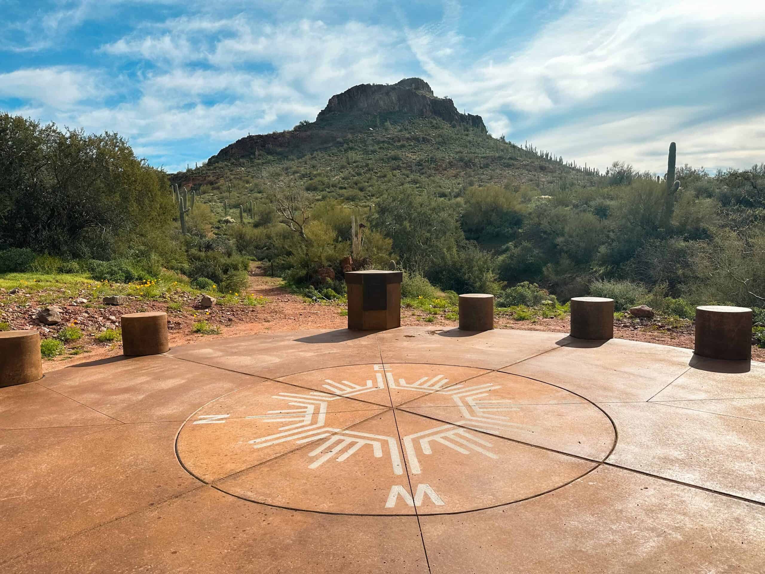
5. Stargazing Trail
Hiking Distance | 0.3 miles
Difficulty | Easy
The Stargazing Trail is a short trail that features the star gazing node (pictured above). The node is about 0.1 mile in while the rest of the trail will connect you with Oro Vista Loop or a connector trail to Saguaro Loop.
The star gazing node is an extra feature the park included and I’m all for it. In the middle is a dial notating the North, South, East, and West directions, while surrounding the outer edges are individual concrete seats. Since Peralta Regional Park is so far out and has no artificial lighting, this is the perfect place to come stargaze if you’re staying past sunset or camping.

6. North Star Trail
Hiking Distance | 0.8 miles
Difficulty | Difficult
Short but mighty, the North Star Trail is definitely the most strenuous trail within the park. To access it you must hike a portion of the Desperado Trail. Once you turn onto North Star Trail it quickly becomes steep- you’ll climb 283 feet in 0.4 miles!
When I hiked the North Star Trail I had no idea what it was leading to and was secretly hoping it was going to be worth it because my calves were burning and it couldn’t be for nothing. Luckily the trail ends at the top of a little mountain with an overlook. While the overlook at the top is very small, the views are vast. You can see the entire Peralta Regional Park from this spot!
If you can handle the steep climb I’d highly suggest North Star Trail. If you’re lucky to get the spot to yourself it can be a peaceful place to sit and take in the views.
7. Serenity Loop
Hiking Distance | 1.2 miles
Difficulty | Easy
If you’re looking for an easy trail to simply stretch your legs and breath some fresh air then consider Serenity Loop. This loop is a very family friendly hike and sits somewhat in the middle of the park. It connects many of the picnic ramadas and loops around the Interpretive Trail.
I was surprised at how serene and beautiful this area is! It is lush with vegetation and surrounded by mountain views. An early morning or late evening hike along Serenity Loop is highly suggested for your itinerary!

8. Interpretive Trail
Hiking Distance | 0.52 miles
Difficulty | Easy
Interpretive Trail sits inside the Serenity Loop and is another easy, flat trail in Peralta Regional Park perfect for children, beginners, or those that have more limitations. The surface is a loose gravel and clear of any large rocks, sticks, etc. Along the way there are interpretive signs that teach about the local history and plants.
This is a great introductory trail to begin your adventures within Peralta Regional Park!
Other Hikes Near Peralta Regional Park
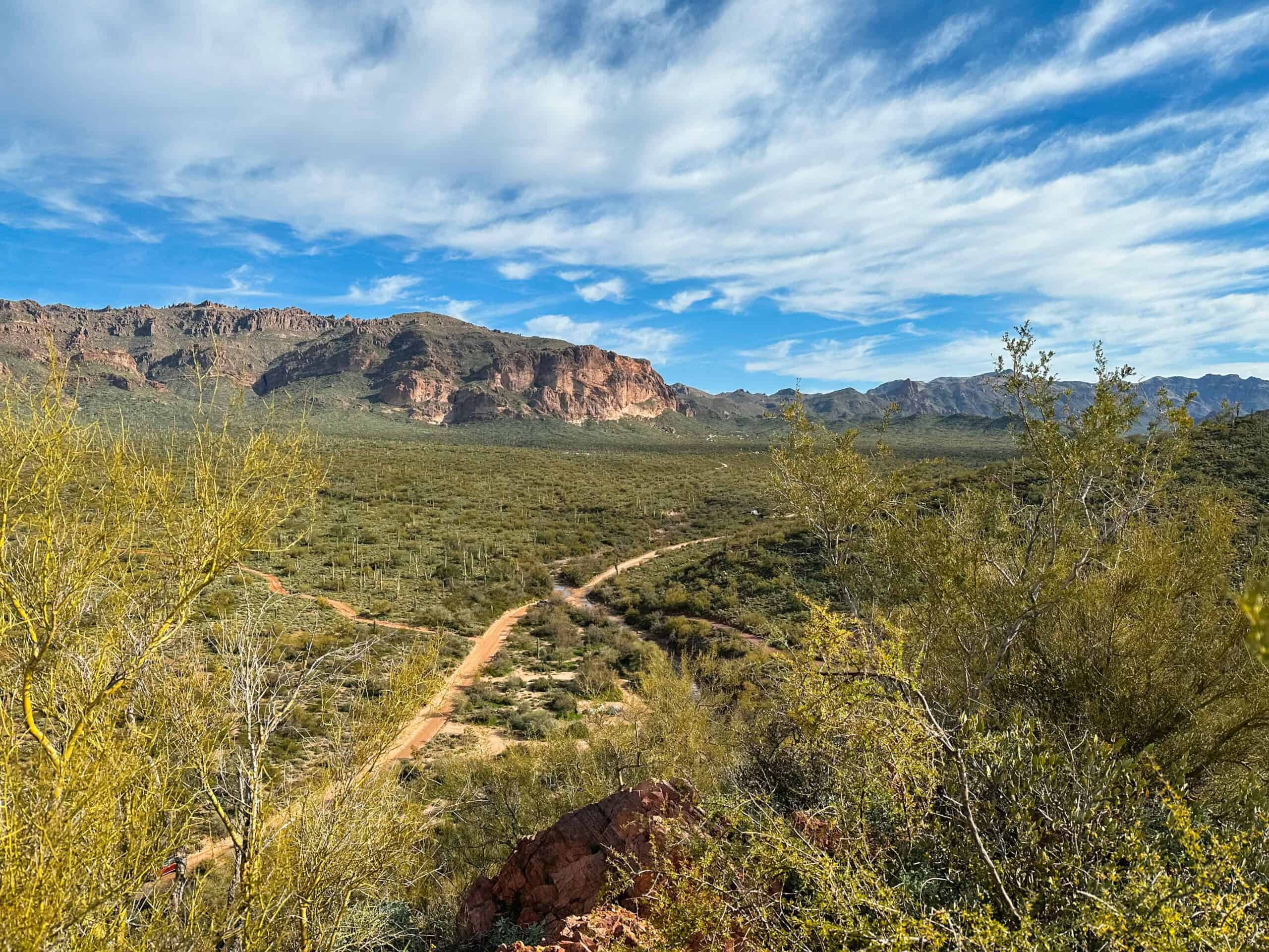
If you continue down Peralta Road, which is the dirt road the park is located off of, it leads you to some pretty great hikes. These hikes bring you further into the Superstition Mountains and provide outstanding views. I highly suggest adventuring outside of the regional park during your visit!
These hikes require a bit more effort and especially water than those within Peralta Regional Park. Nonetheless, I’m positive you’ll enjoy your time on any one of these trails.
- The first trailhead you’ll come across is the the Carney Springs Trailhead. This leads you to some awesome places like The Wave Cave and a very difficult hike to Three Sisters Summit.
- At the end of the road you’ll dead end at the Peralta Trailhead. From here you can hike from Peralta Trail To Fremont Saddle for some of the best views of Weavers Needle. Or you can continue to hike a large loop around the iconic rock formation- Weavers Needle Loop.
Camping In Peralta Regional Park
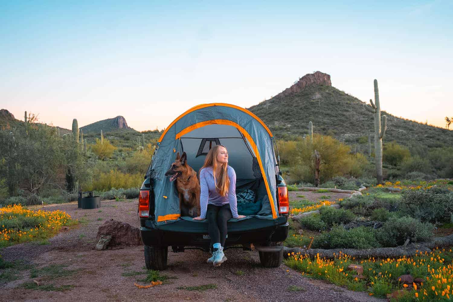
If you’re going to visit Peralta Regional Park you might as well make the most of it and stay a night or two! Camping in the park is not only convenient but it adds to the overall experience. This landscape is so beautiful and being able to witness how sunset and sunrise bring it to life is a huge bonus!
The park was designed to provide primitive camping and backpacking experiences. This means the sites are quite rustic and not overly developed.
Types Of Camping Allowed Within The Park
- Car, van, truck, etc.
- Tent
- No trailers or RV’s are permitted. This includes vehicles over 20 feet in length.
I chose to camp in our truck bed tent which sets up just like a normal tent with the addition of hooks on the sides and front which are secured under the truck. I absolutely love camping in this tent because it gets us off the ground and has ample head room. It also utilizes the tailgate so you can set your shoes and miscellaneous things out of the way.
Is There Cell Service?
Typically when I’m camping I make it a point to not be on my phone scrolling social media or texting people, however it is a comfort knowing you have service incase of an emergency. I was surprised that I had full bars in Peralta Regional Park and could make phone calls, send texts, etc. with T Mobile.
What Are The Campsites Like?
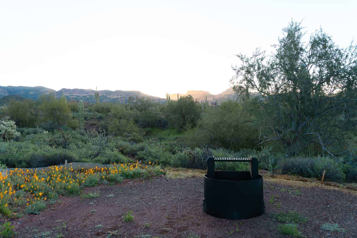
As for the campsites themselves they are pretty spacious. Each campsite has a ‘driveway’ for you to park in and a large stone blocking you from driving in any further. There is a large clearing for a tent or two to be set up as well as a concrete picnic table.
I believe every campsite has a fire pit but not with a grill on top. When booking your reservation online be sure to read the description of each to be sure!
Book your Peralta Regional Park campsite here!
Peralta Road Dispersed Camping
There is free dispersed camping off of Peralta Road, but recently it has become over populated and dirty because people aren’t picking up after themselves. This is an option, but I still suggest paying the small fee to camp within the park since it is set back and more private. It is clean, quiet, and you won’t have generators keeping you up at night!

Final Thoughts On The New Peralta Regional Park
It isn’t often a new park comes to town! I was so excited to hike and camp at Peralta Regional Park once it opened. I wanted to experience it for everything that it is so I booked a campsite and set out to hike every trail. Now, I’m hooked.
I’ll most definitely be visiting again soon to camp and spend time under the stars. The Peralta Road dispersed camping has become so populated now and dirty, so it is worth paying $10 to camp in a clean and serene campground.
I hope this guide has been able to help you plan your itinerary. If a future trip is in store for you, share in the comments below!
You may also enjoy:
- 10 Amazing Superstition Mountains Hikes for your Bucket List
- Hiking Black Top Mesa In The Superstitions Is Worth It
- Ultimate Picacho Peak Hike Guide via The Hunter Trail
- Visit the Old West Town of Tortilla Flat, Arizona